Ceará
Interactive Maps: Infrastructure, Health, Education, Energy, and Much More
12:45 28 de April de 2023 Por Daniel Oiticica
Would you like to know the real dimension of the road infrastructure of the city of Sobral? Or how the educational network of Juazeiro de Norte is structured? Or how many wind farms there are and where they are in the region of Amontada?
Ceará, Land of Opportunities presents below the interactive maps, prepared by Ipece (Institute for Research and Economic Strategy of Ceará), in partnership with i3Geo. They show how the infrastructure of roads, railroads, airports, water and energy is made up, as well as the education and health networks, and many other aspects of the situation of each municipality in Ceará.
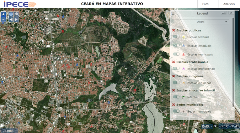
On the maps, the user can search for information on each municipality, using the filter tool, available on the Catalog icon, found on the sidebar on the right side of the screen.
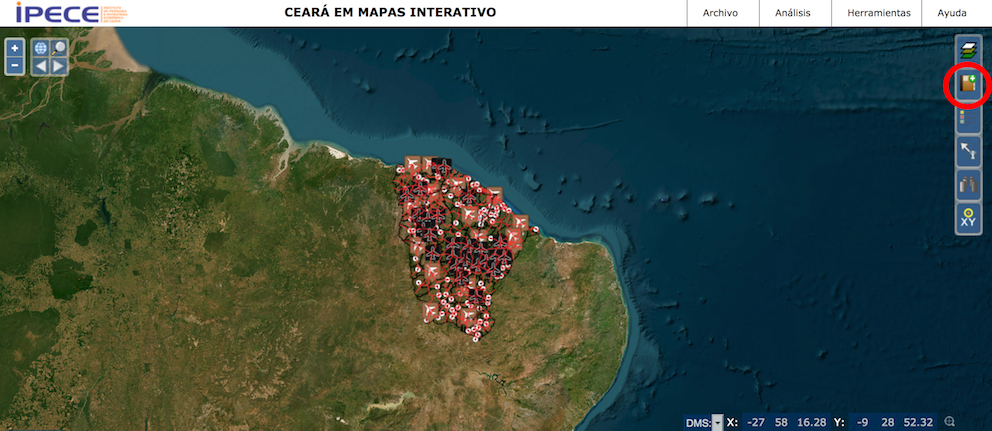
By clicking on the icon, the user finds the search tools. From there, the search possibilities are extensive.
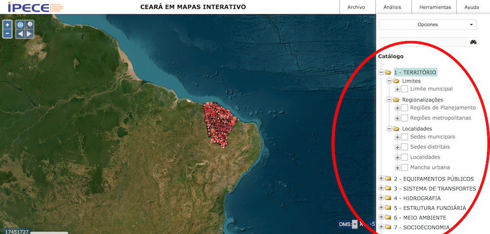
It is possible to search comprehensively throughout Ceará in general, by choosing the available parameters (Territory, Public Equipment, Transportation System, Hydrography, Land Structure, Environment, and Socioeconomics) by clicking on the + symbol in each of the folders.
Each folder has its own subfolders, which define the search parameters. The TERRITORY folder, for example, is subdivided into Boundaries (Municipal boundaries), Regionalization (Planning Regions and Metropolitan Regions) and Localities (Municipal Seats, District Seats, Localities, and Urban Areas), and so on.
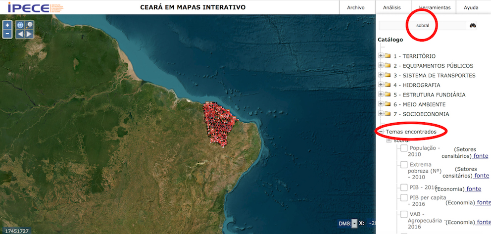
The maps also allow searching by municipality. In this case, the user must type the name of the municipality in the field where the binocular icon is found.
By typing the name of the municipality and pressing the Enter key, the screen shows all the search parameters related to the municipality. By clicking on the chosen parameters, they will appear on the map. There are more than 70 search parameters, such as population, nursery schools, airports, wells, police stations, ports, railroads, highways, and many others.
Another possibility is to access each map according to specific themes. The filters explained above can be activated on any of the maps chosen.
See here the interactive map of road, railroad and airport infrastructure.
See here the interactive map of the water infrastructure.
See here the interactive map of the education network.
See here the interactive map of health care facilities.
See here the interactive map of the energy infrastructure.
Now it is time to plan the investment, choose the best place according to the needs of the new business, and follow the step-by-step for the investor.